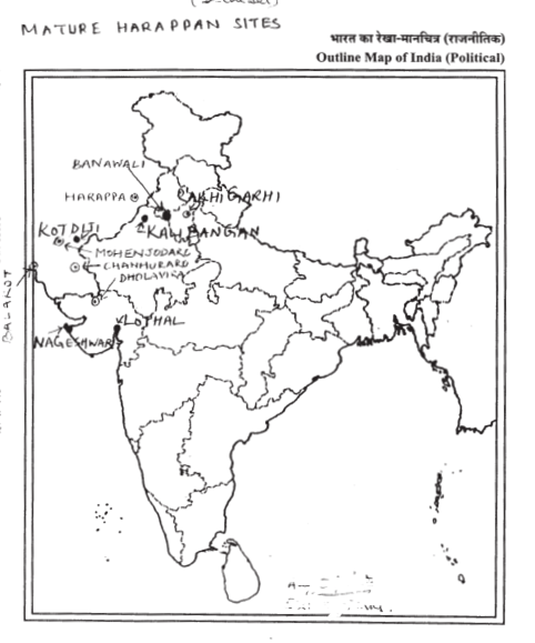
On the given political outline map of India mark and label the following mature Harappan sites Rakhigadi, Nageshwar, Lothal, Kalibangan, Kotdiji.
OR
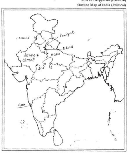
On the given political outline map of India mark and label the following territories under Babar, Akbar and Aurangzeb: Delhi, Goa, Agra, Ajmer, Amber.
Mention the two sections of the Harappan Settlements and give one main feature each.
The settlement is divided into two sections, one smaller but higher and the other much larger but lower.
Archaeologists designate these as the Citadel and the Lower Town respectively. The Citadel owes its height to the fact that buildings were constructed on mud brick platforms. It was walled, which meant that it was physically separated from the Lower Town. The Lower Town was also walled. Several buildings were built on platforms, which served as foundations.
Describe briefly the drainage system of the Harappan cities.
Drainage system of Harappan cities-
(i) The drainage system was planned very carefully.
(ii) Road and streets were laid out along an approximate grid pattern intersecting at right angles.
(iii) Streets were laid out with drains and he drains were covered.
(iv) The houses were built along them. Domestic waste water had to flow into the street drains.
(v) The drains could be cleaned at regular intervals. The drains were made of burnt bricks
Who was John Marshall ? How did he mark a change in the Indian Archeology ?
John Marshall was an archaeologist
He announced the discovery of a new civilization i.e. Indus Valley Civilization/ Harappa culture
’The most unique features of Mohenjodaro was the planned urban centre. ’ Support the statement with examples.
The most unique feature of Mohenjodaro was the planned urban centre:
(i) The settlement is divided into two sections, one smaller but higher and the other much larger.
(ii) On the Citadel buildings were constructed on mud brick platforms.
(iii) The Lower Town was walled and buildings were built on platforms.
(iv) There were signs of planning like bricks, sun-dried or baked, were in a standardized ratio.
(v) Roads and streets were laid out along a grid pattern intersecting at right angles, streets with drains were laid out first, and then houses built along them.


 Switch


